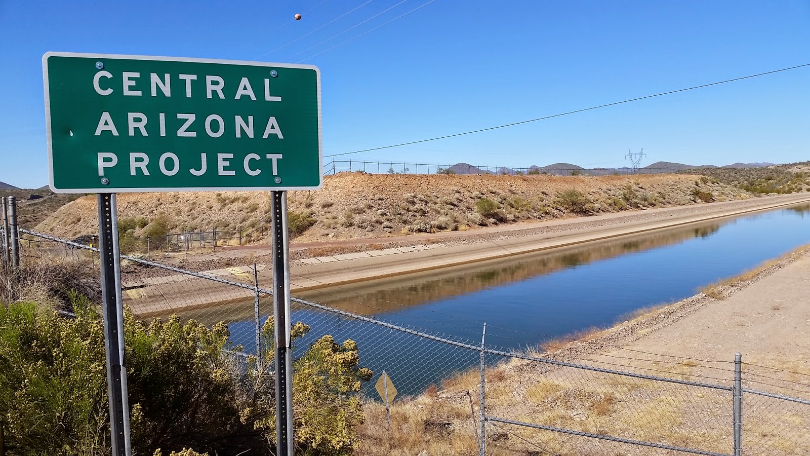
Today we traveled from Casa Grande, AZ all the way to Pahrump, NV, a distance of 407 miles (10,433 total miles now for those who are counting). We only stopped four times: twice for gas and/or rest breaks, and twice specifically for photos. After successfully navigating through the heart of Phoenix on I-10 and I-17 (just after the morning rush hour!), our first photo stop was along highway 74 (officially called the Carefree Highway!) just below Carl Pleasant Dam. I took photos of the Central Arizona Project (CAP), which is basically just a big canal that carries water from the Colorado River to irrigate cotton, sorghum, and other crops as well as provide water for the growing urban agglomerations (such as Phoenix, with 4.5 million people in its metro area now, which is larger than Oregon's entire population of 4 million).
We drove on, through Wickenburg and Wikieup (we spell it Wickiup in Oregon, but it refers to the same Native American dwellings made of willow). Along the way we passed more saguaro and cholla cactus, yucca, and surprisingly, a veritable forest of Joshua trees along U.S. Highway 93. I originally had planned to drive west to Joshua Tree National Park in California, but decided to take this route instead. Little did I know that we would see them anyway, so that was a welcome surprise.
After gassing up in Kingman, we proceeded on to the day's highlight, Hoover Dam on the Colorado River. It was built by the U.S. Bureau of Reclamation in the 1930s to provide flood control, impound irrigation water, and produce hydroelectric power. Lake Mead, the reservoir behind the dam, is the largest reservoir in the U.S. by volume when full. The level was quite low today, however. The Colorado River is infamous for being one of the most over-allocated rivers in North America. In most years, its mouth is dry, with all of the water being diverted for other uses (mostly irrigation, such as the CAP).
We managed to drive through Las Vegas during the evening rush hour (my usual perfect timing), right at dusk. I'm now finally back in the Pacific Time Zone for the first time since September 3, nearly 70 days ago! I'm entering the home stretch, and I feel my foot getting heavy on the gas pedal.
 |
| Joshua trees. |
 |
| A Joshua tree at the town of Wikieup. |
 |
| Looking south from a gas station in Kingman, AZ. |
 |
| This type of scene is one I've become quite familiar with on the road. A nearly daily event. |
 |
| North of Kingman, AZ. |
 |
| Physical geographers and geologist love road cuts! |
 |
| Getting closer to Hoover Dam the topography becomes amazingly rugged. |
 |
| The Colorado River forms part of the boundary between Nevada and Arizona. |
 |
| Walking across the highway bridge (which only opened in October 2010) is not recommended for those with a fear of heights. It was also extremely windy, nearly knocking me off my feet near the edge of the bridge. |
 |
| Lake Mead. |


This comment has been removed by a blog administrator.
ReplyDelete