Today was another perfect fall day. My only goal was to explore Mt. Washington (elev. 6,288 feet), the highest point in the northeast, and one of the highest peaks east of the Rockies. Today was a great day to do it.
There are several options for ascending the mountain. The cheapest (and most strenuous!) is to hike. There is also a cog railway and guided van tours. I chose to drive myself on the Mt. Washington Auto Road, which is quite an adventure. The speed limit is 20 mph and vehicles must use first gear all the way up and down. It's not for the faint of heart: sheer dropoffs of thousands of feet with no guardrails on a narrow, winding, steep (average grade is 12%) road. Oh, and just to make it interesting, usually a very thick fog at least part of the way. I loved it.
Eight miles and about 35 minutes later I was safely at the top. I then spent a total of four hours taking photos and exploring at the summit and on the way down. It was well worth the $28 toll to drive this road. This and Going-to-the-Sun Highway in Glacier NP are two of the most extreme engineering feats accomplished in the history of American road building, and both offer spectacular views. I was actually more impressed today, though. The top of Mt. Washington is half a mile above timberline in an alpine tundra environment, offering 360 degree views.
Once again, photos don't do it justice, but here are some to give you a taste of what it's like.
 |
| The start of the auto road, with some of the Presidential Range in the background. |
 |
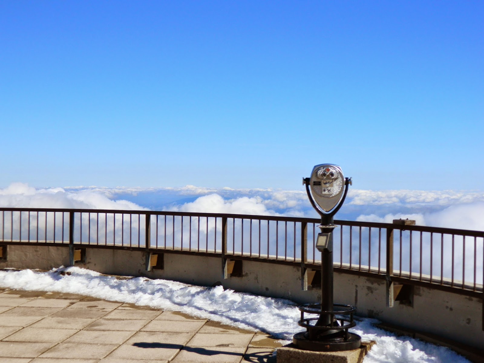
| The view from the top! |
 |
| As you can see, today's weather was great (although the prior night saw a peak wind speed of 67 mph). |
 |
| So as not to exceed the vehicle's weight limit (very important coming down the steep road!). Some hikers try to hitch a ride down. |
 |
| I met a nice couple from Maine who were kind enough to take my picture. The summit is directly behind me. |
 |
| Krumholtz (literally, "crooked trees") are characteristic of subalpine forest just before timberline. The severe climate limits their growth. |
 |
| Interesting ribbons and pockets of color where hardwood trees are located. |
 |
| A nearby ski resort. |
 |
| Back to the bottom! Looking east, away from the Presidential Range. |


I climbed to the top of Mt. Washington once. Not so fun! Want to take the cog railway someday...Glad you enjoyed it!
ReplyDeleteWow Steve, what gorgeous pics and weather! This made my day reading your blog and viewing your photos. Thrilled you are embracing this wonderful adventure you are on.
ReplyDeleteWhat a great Harley road!
ReplyDelete